Read the full story →
Following a request by the Matson & Robinswood Pride in Place Board, the government has agreed to a small change to the Pride in Place map. The change brings the White City estate, including Sapperton Road and Beaufort Road, in to the area that will benefit from up to £20 million of investment over the next ten years.
As well as agreeing to the adjusted map, the government has signed off on the Board’s plan for engaging residents and its budget for the year ahead.
Why the map has changed
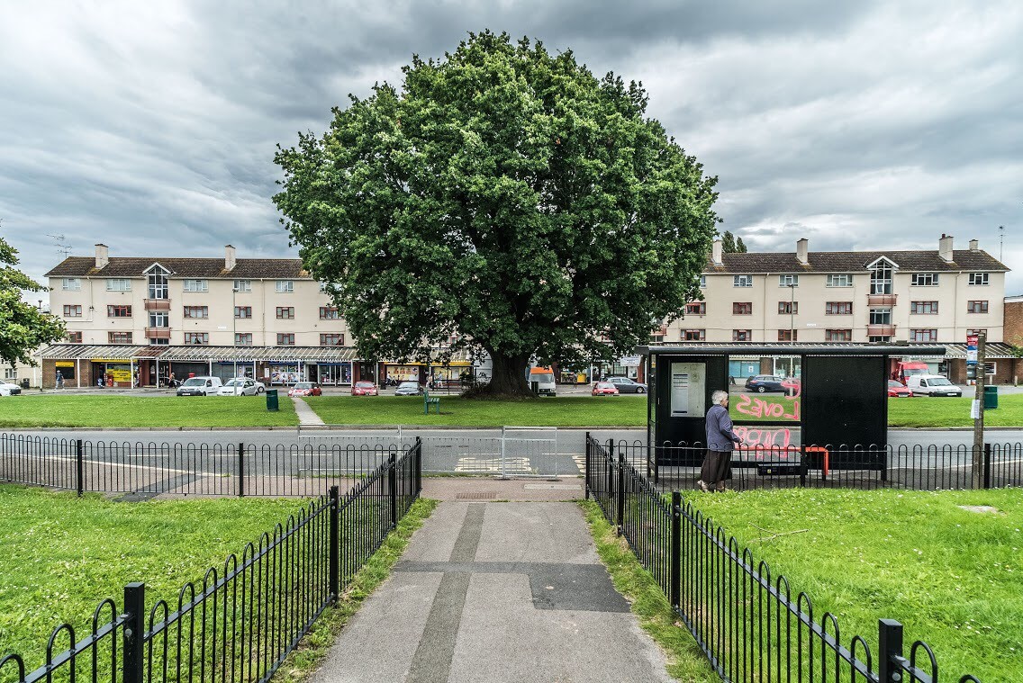
When Pride in Place was announced, the government drew the area using a map the Office for National Statistics uses to count the population. It works well for statistics. But it wasn’t drawn by people who live here, and it doesn’t follow the lines local people recognise. That gave us a map that didn’t quite make sense on the ground. It stretched into roads that wouldn’t call themselves Matson or Robinswood at all. It took in part of White City, including Finlay Community School and Jenkinson Close, but left out the homes on the estate next door, which include many households that school serves. The government invited every Pride in Place area to check its map early and put forward changes where there was good reason. The Board did exactly that.
Why White City?
It’s already one community. Matson, Robinswood and White City have been a single council ward for many years. That will stay the same as local government in Gloucestershire changes. Residents share the same councillors, the same schools, and services, and now the same programme.
Twenty years of working together. The Matson, Robinswood and White CityCommunity Partnership has brought residents, volunteers and local groups togetheracross all three areas for around two decades. Several similar partnerships were setup across Gloucester around the same time. This is the only one still going.
The community already has a plan. The Partnership has written its own plans for the area, including The Power of Three and Common Ground, and they have always covered all three neighbourhoods together. Pride in Place can build on that work instead of starting from scratch.
It’s fairer. Drawing a line through the middle of a community would mean some families could take part and their neighbours couldn’t. Local groups and schools would also have to check postcodes before they could help someone.
How the decision was made
Over the summer, the board asked people for views. Local organisations wrote to us, including residents’ groups, the Community Partnership, churches, schools, the library and local charities, and residents answered an online survey. Most people were strongly in favour. Any concerns people raised were shared with the Board in full. The Board debated the change at its first meeting on 21 August and voted 15 in favour, 1 against, with 3 abstentions.
What does this mean for you?
I live in Matson or Robinswood. Does anything change? No. Nothing has been taken out. Every street that was in Pride in Place is still in it.
Does adding White City mean less money to go round? The total stays the same: up to £20 million over ten years.
I live in White City. What now? You’re in. Your views count in the same way as everyone else’s, and will contribute to the development of the Neighbourhood Plan
What happens next
The government has also approved the Board’s engagement plan and this year’s budget. That means:
-This autumn: local community groups are being funded to hold conversations with residents about what matters to them and what they’d like to see change.
-January: a community event will bring together everything people have told us, and we will prioritise what matters most.
-February: residents’ ideas will be turned into a ten-year plan for the area, and investment will arrive from April 2027.
A word from the Chair
Jason Dunsford, Chair of the Neighbourhood Board, said:
“This is a small change to a map, but it matters a great deal to the people who live here. Matson, Robinswood and White City have stood together in partnership for decades. They share a ward, a 20 year old community partnership and a plan for the future. It never made sense for Pride in Place to stop halfway across an estate, or to include a school but not the families it serves. I’m grateful to everyone who gave their views and to the Board for weighing this up so carefully. Now the map is settled, the real work starts: hearing from as many residents as possible about what this money should do.”
To be kept up to date about Matson & Robinswood Pride in Place, please visit the website, sign up to our mailing list, and follow us on social media.